
Guilin to Yangshuo Golden Cycling Route: 90km Route & Safety Guide
Explore the 90km Guilin to Yangshuo Golden Cycling Route with 632m elevation gain. Includes details on paved roads, Banbiandu ferry, traffic, and support services.
Cyclequestchina
7/26/2026
Guilin to Yangshuo Golden Cycling Route: 90km Karst Riding Guide
The Guilin to Yangshuo Golden Cycling Route is a point-to-point 90 km ride connecting the central urban district of Guilin with Yangshuo County in Guangxi, China. Covering 632 meters of elevation gain across rolling paved terrain, this route traverses iconic Karst limestone peaks, historical riverside towns, national highways, and a local river ferry crossing at Banbiandu. Designed for cyclists with a solid endurance foundation, the route offers a complete day-long ride through the heart of Guangxi's landscape.
Key Facts
Location: Guilin City and Yangshuo County, Guangxi Zhuang Autonomous Region, China
Start and finish: CycleQuest Guilin Hub to CycleQuest Yangshuo Hub
Route type: Point-to-point
Distance: 90 km
Elevation gain: 632 m
Highest elevation: Low-altitude rolling hills (under 300 m)
Pure riding time: 6–8 hours for experienced cyclists; 8–10 hours for leisure/less experienced cyclists
Total duration: 8–10 hours (including meals, rests, and ferry wait times)
Difficulty: Challenging
Road surface: Fully paved (primarily national highways)
Traffic: Moderate to high (mixed traffic including motor vehicles and trucks on national highway sections)
Recommended bike: Road bike or Fitness/Hybrid bike (E-bikes recommended for endurance management)
Best season: March to July
Suitable riders: Cyclists with solid physical conditioning and long-distance road experience
Latest route inspection: July 25, 2026 by Guangxi Qiyi Culture Tourism Development Co., Ltd. (CycleQuest China Team)
Route Overview
The Guilin to Yangshuo Golden Cycling Route provides a comprehensive cross-county journey following the corridor of the Li River system and surrounding Karst topography. Starting from the CycleQuest Guilin Hub, the route travels south toward the historical town of Daxu, passes through Caoping Town, reaches the scenic cliffside river cutoff at Banbiandu, and cuts inland through Putao Town before finishing at the CycleQuest Yangshuo Hub.
Unlike short recreational river loop rides, this 90 km route combines scenic riverfront stretches with active national highway segments, introducing cyclists to both authentic rural market towns and bustling regional transit corridors.
Route Breakdown
Section 1: CycleQuest Guilin Hub to Daxu Ancient Town
Distance: Approx. 20 km
Terrain: Mostly flat paved urban and suburban roads
Highlights: Transitioning from urban Guilin into countryside along ancient river trading routes
Traffic & Surface: Paved suburban road with moderate local city traffic
Section 2: Daxu Ancient Town to Caoping Town
Distance: Approx. 25 km
Terrain: Rolling paved hills with gentle climbs
Highlights: Ming and Qing architecture in Daxu, scenic riverside roads entering Caoping
Resupply: Food, water, and restrooms available in Daxu and Caoping towns
Section 3: Caoping Town to Banbiandu (Ferry Crossing)
Distance: Approx. 15 km
Terrain: Riverside paved roads leading to the river terminal
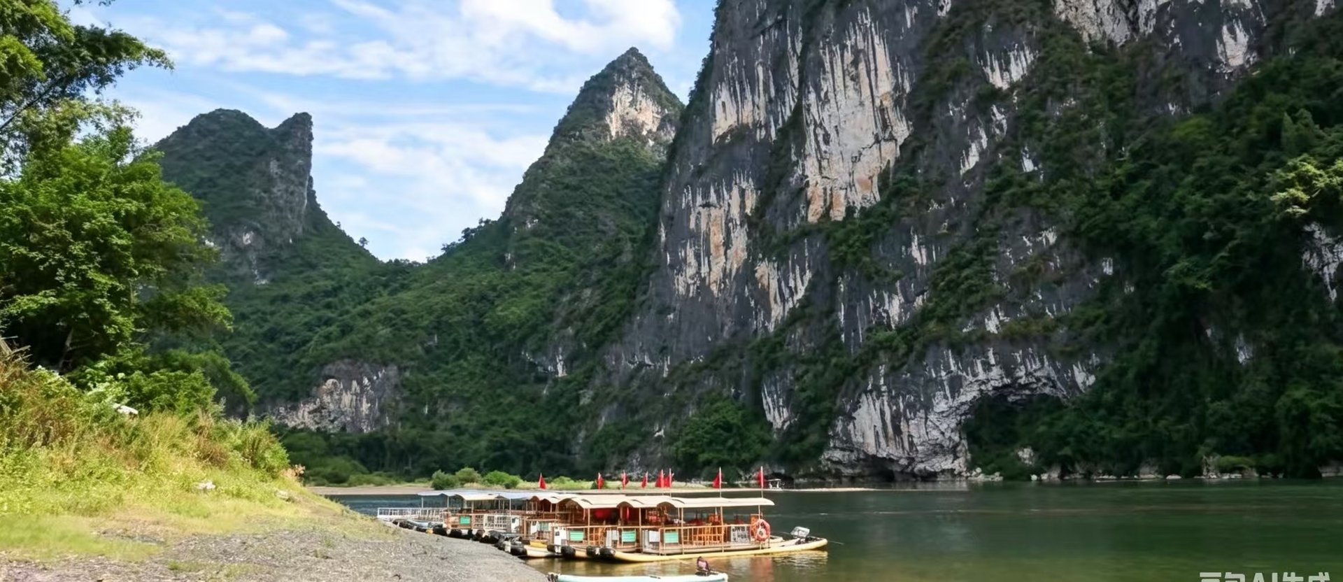
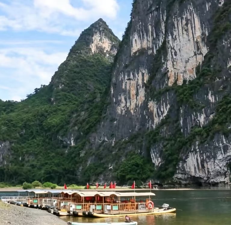
Key Detail: At Banbiandu, where vertical Karst cliffs meet the Li River, cyclists must board a local ferry boat to cross the river with their bicycles before continuing on land.
Section 4: Banbiandu to Putao Town
Distance: Approx. 15 km
Terrain: Incline climbs including the route’s steepest climb (1.66 km at up to 7.9% gradient)
Traffic & Surface: Joining national highway sections with higher motorized vehicle traffic, including heavy trucks
Section 5: Putao Town to CycleQuest Yangshuo Hub
Distance: Approx. 15 km
Terrain: Rolling descents and flat paved highway stretches
Highlights: Entering the peak-forest Karst valley surrounding Yangshuo County
Distance, Elevation and Difficulty
Covering 90 km with 632 m of total elevation gain, this route is classified as Challenging. While the overall elevation gain is moderate over 90 km, the cumulative distance demands good cardio capacity and physical stamina.
The route features 6 distinct climb segments. The most demanding section is a 1.66 km climb with a maximum gradient of 7.9% located in the second half of the route. Experienced endurance riders can complete the pure riding time in 6 to 8 hours, while less experienced cyclists should plan for 8 to 10 hours of total duration to accommodate pacing, meals, and ferry boarding delays.
Road Surface and Traffic
The route is entirely paved, consisting mostly of asphalt national highway stretches and regional paved access roads.
Vehicle Traffic: Because major portions follow national highways, riders will share the road with motorbikes, passenger cars, tour buses, and heavy trucks.
Safety Considerations: Cyclists must stay on the right side of the lane, maintain vehicle awareness during highway descents, and use active front and rear lights when riding through shadow areas or during low-light conditions.
Who Is This Route For?
Suitable For:
Experienced road cyclists accustomed to 80+ km rides on shared public roads.
Fitness-oriented cyclists looking for a continuous, full-day cross-county ride in Guangxi.
Riders using performance E-bikes who want to cover long distances with electric pedal assist.
Not Suitable For:
Children or young beginners.
Novice riders without prior experience riding in traffic alongside heavy motorized vehicles.
Recommended Bike and Gear
Recommended Bikes: Road bikes (for speed and efficiency on paved highways) or Flat-bar Fitness/Hybrid bikes (for comfortable upright posture).
E-Bikes: Recommended for riders looking to manage fatigue over 90 km.
Gear Essentials: Helmet (mandatory), front headlight, red rear light, fully charged phone, offline GPX navigation app, and basic flat-repair kit.
Clothing: Moisture-wicking cycle wear, sun sleeves, UV protection, and lightweight rain gear (especially during spring rain months).
Resupply and Pacing
Water and food resupply points are plentiful along the route in key town nodes:
Daxu Ancient Town: Full resupply (water, local snacks, meals, restrooms).
Caoping Town: Resupply point prior to the ferry crossing.
Putao Town: Highway resupply point after the main climbing section.
Pacing Tip: Avoid pushing too hard on the early flat sections before Daxu. Save energy for the inland climb segments after the Banbiandu ferry crossing.
Best Season and Weather
Best Months: March to July, offering green foliage and good visibility through the Karst valleys.
Rainy Season Risks: February to May experiences frequent spring rain and high humidity, causing damp and slippery paved road surfaces. Extra caution is required on downhill corners.
Altitude & Heat: The route stays in low-altitude terrain with no mountain sickness risk, but summer temperatures can be warm; adequate hydration is essential.
Navigation and Safety
Navigation: A GPX track is available for navigation. The route follows defined paved corridors, making orientation straightforward.
Ferries: Keep local RMB currency or mobile payment ready for the Banbiandu ferry fare. Exercise caution when loading and unloading bicycles on the ferry ramp.
Truck Traffic: Exercise defensive riding habits when riding along national highway sections with heavy truck traffic.
Guided or Self-Guided Options
Self-Guided: Independent cyclists with highway riding experience and offline GPX capability can navigate this route independently.
Guided Support via CycleQuest China: Guangxi Qiyi Culture Tourism Development Co., Ltd. (CycleQuest China) offers full-service packages including bike rentals, English-speaking cycling guides/translators, ride logistics, safety insurance, and mechanical support. Paid support vehicle support (SAG vehicle) and emergency rider pickup can be arranged upon request.
Frequently Asked Questions
How difficult is the Guilin to Yangshuo Golden Cycling Route?
The route is rated Challenging due to its 90 km distance, 632 m of climbing, and national highway traffic sections.
Is the entire route paved?
Yes, the route consists entirely of paved roads, primarily national highways and paved town access roads.
How do cyclists get across the river at Banbiandu?
At Banbiandu, the land route is interrupted by vertical river cliffs. Riders board a local passenger/bicycle ferry boat to cross the river with their bikes before resuming the ride on the opposite bank.
Can I use an E-bike for this 90 km route?
Yes, E-bikes are highly recommended for riders who want assist over long distances. Ensure your battery capacity is sufficient for 90 km with 632 m of climbing.
Is there heavy vehicle traffic on this route?
Yes. Certain sections follow national highways where motorbikes, cars, and heavy commercial trucks operate. Riders must remain attentive to traffic.
What services does CycleQuest China provide for this route?
CycleQuest China provides bicycle rentals, mechanical assistance, ride insurance, route design, and optional paid services such as English-speaking guides, support vehicles, and transfer pickups.
Sitemap
Phone
+86 18310259331
© 2003 - 2026 CycleQuest China All rights reserved ! Terms | Privacy Policy